Wet shoes, a blister on my little toe and a bruise the size of a fist on my backside. That is how my hike on the Fishermen’s Trail in Portugal ended. And yet it was one of the best experiences I have ever had.
This is part two of my hiking journal on the Fishermen’s Trail Portugal. I started this trip on the Historical Way, walked three stages to Porto Covo, and then switched to the Fishermen’s Trail for coastal hiking along the Atlantic. Part one ended in Odeceixe. In this article, I take you through the final six stages: from Carrapateira via Sagres and Cabo de Sao Vicente to the finish line in Lagos. You will read which stages are truly challenging, where I stayed overnight, and what happens when you are standing in a flooded path with no idea how to get to the other side.

Stage 8: The last 10 km to Carrapateira
I had finished stage 5 in Odeceixe, a pleasant village just slightly inland. The forecast for the next day: heavy rain. That evening I sat at dinner with a British guy, an Indian man and a German woman named Eva. Eva told us she had decided to take an Uber the next morning to skip ahead and walk only the final 10 km of stage 8, into Carrapateira. That sounded good to me.
After coffee with the Brit (his trip was done, he was heading back to Lisbon) and the Indian man (also his last day, then an evening bus to Lagos), Eva and I got into an Uber. An electric one, driven by a Ukrainian.
We got out at Monte Novo and started walking. The pace matched well enough, which is always a relief. Long tracks heading toward the coast, gently rolling, not much to look at along the way. When we reached the coast, the rain started. Not a drizzle: it absolutely poured. We walked the beach section and got completely soaked. At some point I felt the water seeping into my shoes.
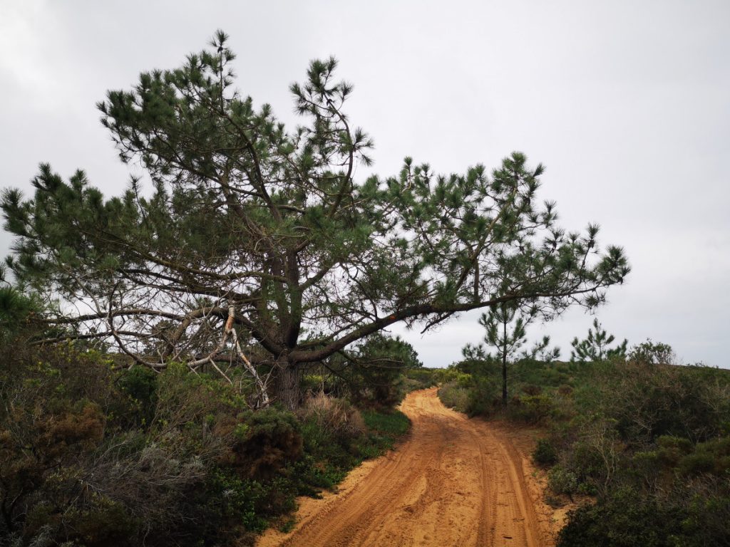
Hard to see in the photo, but the red/white and green/blue trail markers are painted on the overhanging branch.
At the first turning toward the village of Carrapateira we missed the route and ended up on a long stretch of tarmac. We were not paying attention anymore. We were just walking straight toward the goal: a dry house and a hot shower.

I literally poured water out of my shoes when I got inside. There was an actual puddle in there. I had never experienced that before. That afternoon and evening Eva and I had a great meal at Micro Bistro Bar. What a great little place.
Where to stay in Carrapateira: I stayed at Casa Luminosa and Carrapateira Lodge. Both are solid guesthouses where you can choose between a private or shared bathroom. Both have a kitchen and a garden.
Do you also want to hike to the most southwestern tip of Europe? Join me on this trail in december ’26 – read all about that trip
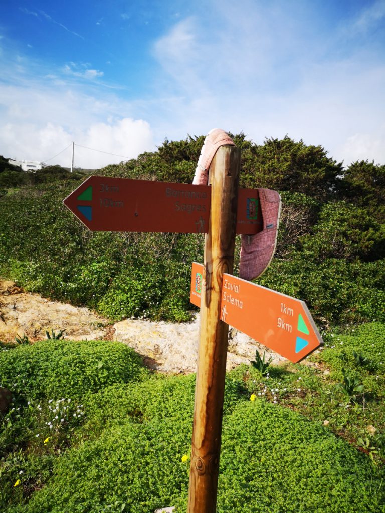
Stage 9: Carrapateira to Vila do Bispo (16 km)
Eva and I started together in the morning, but after 2 km I pulled ahead. Not because I walk faster, but because I take my photos more quickly and can grab my water without stopping. By the time we hit the coast, I was on my own again.

This was a fantastic stage, and a genuinely challenging one. There are sections where you need to climb and scramble and really focus. Not suitable for everyone. I loved every minute of it. It stayed dry all day and I passed beautiful spots: campervans belonging to surfers, long-term travellers who had clearly decided a long time ago that working for money was not for them.


Enjoying my time hiking along the coast in Portugal

At one point there was a sign: if the ocean does not allow passage, turn back. After a steep descent, a short beach crossing and a climb up between two coves, I arrived at one of the most beautiful spots on the entire trail.

Warning signs hiking along the coast in Portugal


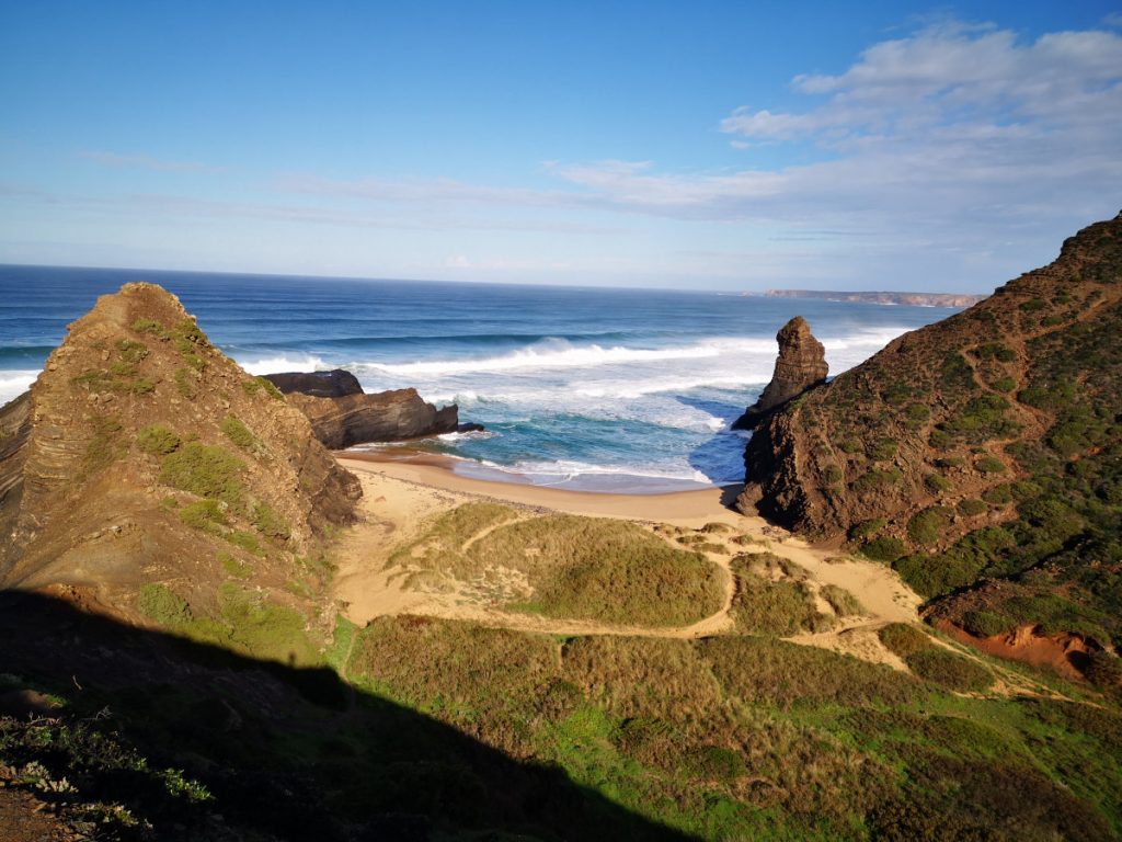
The path you left going down the mountain was a pretty challenging one. So then we crossed that bit of beach and then went back up. This was a really super cool bit to hike and definitely not meant for sissies 🙂
Further along I walked through a nature reserve and heard hunters nearby. After a long stretch the Fishermen’s Trail markers suddenly disappeared.

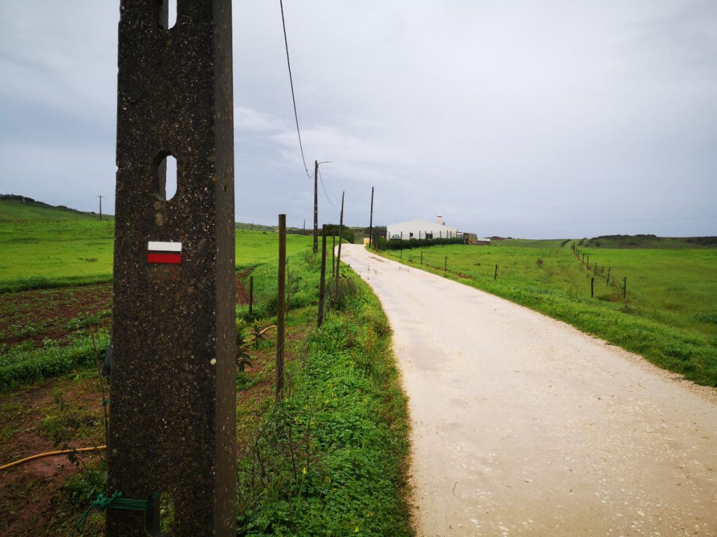
The Historical Way signs were still there and since that route also goes to Vila do Bispo, I followed those. Strange, really: for the entire route both trails are signed together, and then suddenly only one of them gets marked.


A few kilometres along the main road and I arrived in Vila do Bispo. It was only 12 noon. I could already check in, showered straight away, and less than an hour later I was sitting on the terrace next to Eva, who had just arrived, eating lunch. That afternoon I went for a swim in the indoor pool.
TIP for stage 9: There are no restaurants or shops along this route to stop for lunch or refill water. Make sure you carry enough for the entire day.
Where to stay in Vila do Bispo: I stayed at the lovely Hotel Mira Sagres.

More accommodation options in Vila do Bispo
Stage 10: Vila do Bispo to Sagres (20.5 km) via Cabo de Sao Vicente
Rain was forecast for the entire day, perhaps clearing slightly in the afternoon. Over breakfast I was already thinking: I will just book an extra night, go swimming and finish my book. But when I walked back to my room, it had barely started raining. So I got dressed properly: plastic bags around my gaiters, shorts with a phone pocket, rain cover on the pack, poncho on. Let’s go.

I needed to follow red/white markers first. When I spotted them I just followed along. Forty minutes later I thought: why am I heading inland? I had ended up on a completely different European long-distance route. I had not even looked at which destination was marked on the signs. Just started walking. So I turned back, and more than an hour after setting off I was finally on the right track. Soaked by then, not from the rain but from condensation under the poncho. Not cold, just damp.

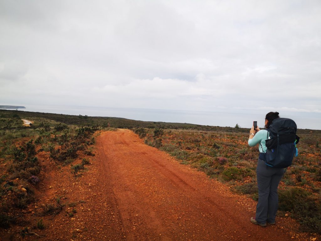
I walked out of the village, along long tracks toward the coast. I passed a man herding cows and sheep. After a while the sky began to clear and I realised the Atlantic had been right beside me for some time already. A little later I was back on the green coastal paths, rolling between high and low along the bays. The sea turned that beautiful blue-green colour again, just like the trail markers.


After a stretch of beautiful coastal paths I went slightly inland and hit a long section of rocks. This continued all the way to the road toward Cabo de Sao Vicente. Difficult going: first trying to walk on the ground between them, then only on the larger rocks, then a combination. Not enjoyable.
Cabo de Sao Vicente came into view and the lighthouse was covered in scaffolding. A shame. The restaurant was also closed. My little toe had developed a blister and my socks were wet. I sat on a wall for a while with bare feet, let the socks and shoes dry a little and lanced the blister. Then everything back on for the final stretch to Sagres.

The last few kilometres into Sagres were rocks, rocks and more rocks. Not pleasant with a blister. But after about a kilometre of walking the blister settles into the shoe and you stop noticing it. A few more beautiful coves and beaches, and I finally arrived in Sagres.


Where to stay in Sagres: I had forgotten to book a hotel and spotted one right before the finish, with a pizzeria and coffee bar downstairs. Perfect. I stayed at Mareta View. At sunset I watched the surfers at the beach. At least fifteen of them out in the water, giving it everything. I know how hard it is: I tried it myself once.

More accommodation in Sagres. I almost always stay at Mareta Boutique Bed & Breakfast, right on the trail with a stunning infinity pool overlooking the coast.
The Fishermen’s Trail – Hiking along the coast in Portugal
Stage 11: Sagres to Salema (19.5 km), the hardest stage
This stage is rated as very difficult. I only found that out a day later, after I had already walked it. But I can confirm: it was the toughest stage of the entire trail. The most elevation gain, the most physical challenge and also the most beaches. A wonderful day.
The weather was perfect and I did not see a single drop of rain. Proper summer weather in December. That alone is a reason to hike the Fishermen’s Trail in winter.
I had breakfast at the hotel, Mareta View Bed and Breakfast, which sits right on the route with a coffee shop and a pizzeria. A kilometre down the road I found a SPAR and picked up a banana and two mandarins for the day.
Shortly after, the route turns left behind a few houses toward the first beach. I had not walked on a beach for a long time. Then through a small nature reserve where the recent rain had left a lot of standing water. I could not immediately see how to get to the other side without soaking my shoes.

Meet the challenge
I could hardly believe this was actually the route. But a few metres ahead I spotted the Fishermen’s Trail marker on the rock face. I had to go through the water to reach it. The rock wall was too steep to traverse.
Standing there, hesitating, I took a few steps in the right direction. And there it was: a row of stones in the water, placed perfectly for stepping on. With my hiking poles for balance it worked well. Until the last stone, the deepest point. Stepping off it would have meant water over the top of my boots. Just as I was about to turn back, I noticed the rock face to my right was less steep than it had seemed. I leaned left for grip, climbed about a metre and suddenly I was exactly where I wanted to be. The path had been there all along; I just could not see it from further away.
Put this in a metaphor for how life works: sometimes you have to take steps in a direction you do not yet know, but that feels right. You cannot see where it leads from a distance. But if it feels right, go. Then paths open up that were available to you all along. I walked with this thought for a long time afterwards.

After that I walked long tracks with the ocean out of sight. Slowly mountains appeared and then suddenly I was at the top of a descent toward a beach with a car park full of campervans. I could hear a guitar.
Hippies at Praia do Barranco


A big camper with a wooden caravan built onto the back. Alternative, relatively young people. A real hippie vibe. Stone windbreaks had been built into the rock. In the one next to me someone was playing guitar and singing softly. Surfers in the water further along. To my left a couple stripping off for a skinny dip. To my right a man on a slackline. I sat there for a good while and just enjoyed it.
Want to visit? GPS Praia do Barranco
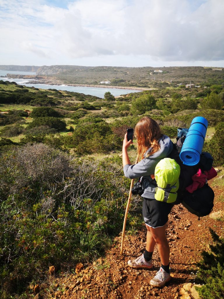
Then straight back into a climb, with stunning views over the bay and the Atlantic. Martina from Croatia had briefly crossed my path earlier and had lost her way for a bit. We walked together to the next cove. She had been travelling for a year through workaway placements, including Iceland, and was in her final week. Next year she planned to start working as a paramedic. I mentioned that in my previous career I had regular contact with ambulance crews.


I took a break at the next cove. After another climb and descent I spotted Martina lying on the beach below in her swimsuit, having taken a dip. I decided to do the same at the next beach. But first, one more serious climb. The paths were still slippery and wet from all the rain.

At the descent toward the beach I slipped and fell. I scraped my calf and the underside of my upper arm and landed hard on my hip. Right on the bone, of course. I got up and decided: this beach is not for me. Back up.

Falling and getting back up
I walked through a stretch of nature reserve with ocean views. For the first time on the trail I saw deer tracks in the ground. At the next cove came a steep sandy descent. So steep and slippery that I slid again, this time with nothing to hold onto. I went down a bit before stopping. This one scared me more than the first fall.
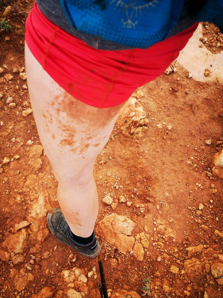
I now understand why people who have even a small fear of something tend to fall more. I became too cautious and kept slipping. I did not fall again but the walking felt wrong. I was relieved when I got to the bottom.
After the next climb I walked through the beautiful Costa Vicentina landscape back toward the coast. Then suddenly I was behind a row of houses in Salema, German number plates everywhere, people clearly spending the winter here with no intention of rushing anywhere.

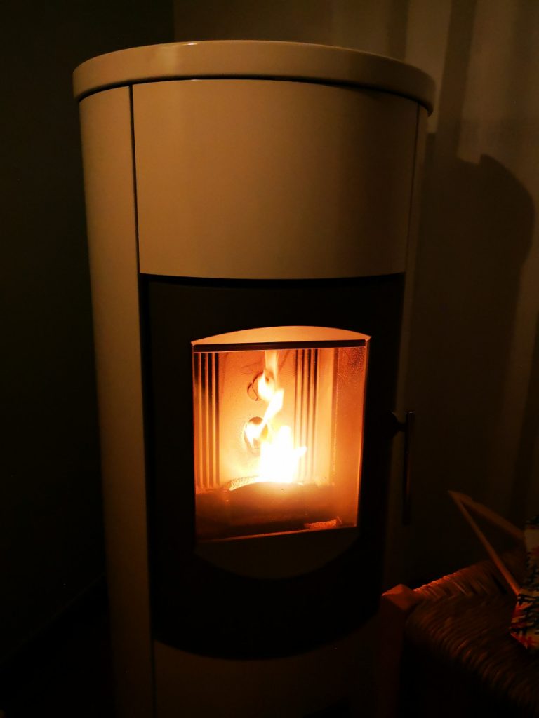
Nothing was open in the village. I walked the next 1.5 km uphill along the road to my studio at Eco Camp Sustainable Camping & Glamping. A lovely spot with a little shop, a good pizza that evening and above all: the wood stove. My sweat-soaked shirt and sand-covered trousers could be washed and dried. Perfect.
Where to stay in Salema: I stayed at Eco Camp Sustainable Camping & Glamping. More accommodation in Salema
Rest day in Burgau
The next morning it was already raining when I woke up. I bought a brioche croissant and a pastel de nata at the Eco Camp shop and ordered an Uber to Burgau. Now I am sitting in an apartment, have cooked pasta and am resting my feet. After a week and a half of eating out every night, this is genuinely nice. Hopefully tomorrow I can walk the last stage.

Stage 12: Salema to Luz, final 5 km from Burgau to Luz
I started early. Rain was forecast from 10 am and the little coffee shop in Burgau opened at 8. After a relaxed evening on the sofa, a good cup of coffee was the perfect start.
Coffee is non-negotiable

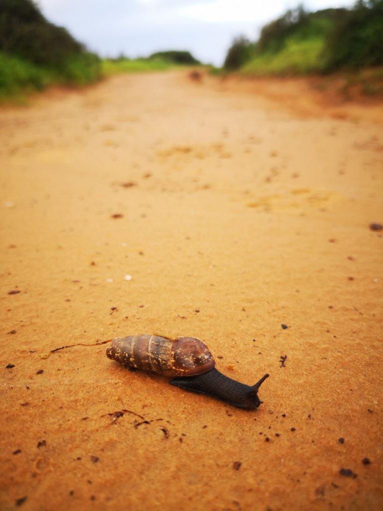
I had looked up the route the day before and knew the shortest way to the path. Soon I was walking along the cliffs with lovely views. Only 5 km to Luz, so no need to hurry. I took my time, photographed snails that genuinely look different from the ones at home, and enjoyed the sunshine.


Just after half past nine I arrived in Luz and heard singing from a church. A religious holiday. The door was open so I stepped inside for a moment to look and listen.
Then I found a terrace on the boulevard. After the first coffee it started to drizzle. After the second it properly rained. I ordered a toastie and waited it out before heading on.
Where to stay in Luz: More options at Luz

Stage 13: Luz to Lagos (11 km) via Ponta da Piedade
The sun came through and after Luz there was a proper climb. It costs you something, but then you get something back: a stunning view over Luz and the Atlantic. Luz is bigger than it looks from the village centre.


The finest views on the Fishermen’s Trail stages Sagres to Lagos
I walked along the top for a while, in the sun, with views across the coastline. Then descended to Porto do Mos, where I sheltered briefly with a German couple in a bus stop. And then: a raised wooden boardwalk along the coast. A pleasure to walk and much more accessible than the rocky paths.


Past a golf course, through a nature reserve busy with day walkers, toward the tip of the headland. I spotted a lighthouse, the route was not entirely clear and I ended up in front of it rather than behind it. I checked the GPX and retraced my steps. Glad I did because otherwise I would have missed Ponta da Piedade.
The wild coast of Portugal: Ponta da Piedade


What a piece of coastline. A beautiful staircase leads down so you can get close to the crashing Atlantic. I spotted a man in swimming trunks standing at the base. Behind him a sign indicating that boats moor there. I did not see any boats. But that man jumped into the water several times when the waves calmed a little, and scrambled out quickly each time. If it had gone wrong, every one of us watching would have been witnesses and none of us could have helped. Strange thing to do. But it went well and the adrenaline on his face was plain to see.

Read more about Ponte da Piedade

After Ponta da Piedade I followed the road, then walked from beach to beach and finally onto the boulevard of Lagos. Past a fort, past a church, and at the harbour: the Rota Vicentina sign. Zero point. The end for me, the start for others.

I had done it. Almost: I skipped three stages. One day I will come back for those, and for more of the Historical Way. But for now I was happy in Lagos, with two more days to explore the city.
Where to stay in Lagos: More options at Lagos
All 13 Fishermen’s Trail stages at a glance
Here is a full overview of the route. The shortest stage is 10 km, the longest 22.5 km. Do not underestimate the elevation: it can make a stage significantly harder than the distance alone suggests.
| Stage | Route | Distance |
|---|---|---|
| 1 | Sao Torpes to Porto Covo | 10 km |
| 2 | Porto Covo to Vila Nova de Milfontes | 20 km |
| 3 | Vila Nova de Milfontes to Almograve | 15.5 km |
| 4 | Almograve to Zambujeira do Mar | 22 km |
| 5 | Zambujeira do Mar to Odeceixe | 22.5 km |
| 6 | Odeceixe to Aljezur | 22.5 km |
| 7 | Aljezur to Arrifana | 17.5 km |
| 8 | Arrifana to Carrapateira | 21 km |
| 9 | Carrapateira to Vila do Bispo | 16 km |
| 10 | Vila do Bispo to Sagres | 20.5 km |
| 11 | Sagres to Salema | 19.5 km |
| 12 | Salema to Luz | 12 km |
| 13 | Luz to Lagos | 11 km |
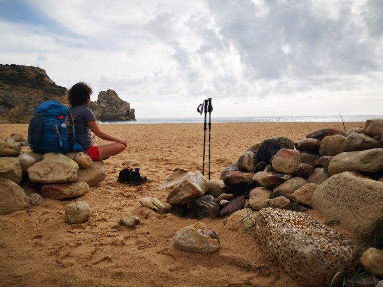
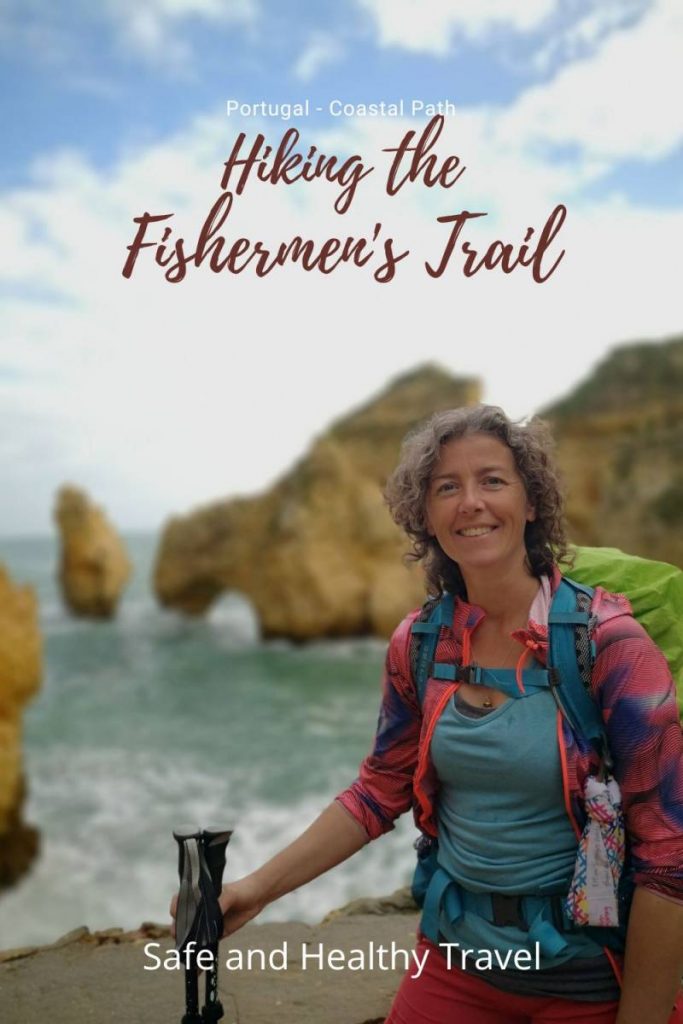
I walked the entire Fishermen’s Trail with hiking poles. They take the pressure off your body and save energy, which means you cover the kilometres more easily and have more left over to actually enjoy the scenery.
Join a guided walk on the Fishermen’s Trail
In December 2026 you can join Zinvol Reizen on the Historical Way and Fishermen’s Trail. The December 2025 edition is already full. Want to walk six days to the most southwesterly point of mainland Europe in a small group?
Read more and sign up: Fishermen’s Trail guided walk
Want to read up before you go? Order the Fishermen’s Trail guidebook by Cicerone. It covers the route combining both the Fishermen’s Trail and the Historical Way, which does not always match reality exactly, but gives a solid picture of what to expect.
Looking for some more?
- Complete Guide 6 Stages Costa Brava + Practical Tips
- Karpathos Hiking Trails – Greece
- Hiking in a Wadi – Oman / Jordan
- Doing a 8 days pilgrimage in Spain – Camino Frances
- 8 days on the Alpe Adria Trail – Austria
This article contains affiliate links. If you book or buy something through one of these links, we may receive a small commission at no extra cost to you.